Come out with us for a bike ride
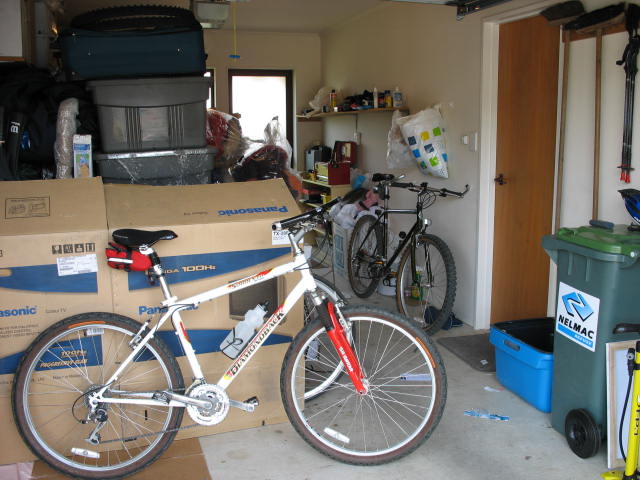 For the second time this week, and since Don put the bikes together, we headed off today on a bike ride with our mountain bikes. The road bikes still need some work and we have to scout out suitable road cycling terrain too, given the debris and rough roads here. But the mountain bikes are giving us a great chance to get out and explore new parts of Nelson and parts we've seen but not up close yet.
 We headed out midday, about noon, and darnit if the sun didn't get blown away by clouds. We had a beautiful morning, not a cloud as we walked to market and did our fruit and veg shopping, but it wasn't to last as the clouds came in. Luckily no rain. We headed out northward toward the water on the bike path and this is our first roundabout--you can see the bay just beyond the road. Here we turned toward the west.
 Heading west takes us back over the Maitai River, the same river we live near, and over this bridge. Then you turn around on it and go back under it. From this viewpoint, the river heads out to the left and into the bay.
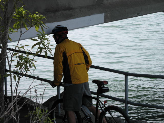
WHOA, Don!! Watch your head there, mate! Low overpass, or should I say, not the best underpass for cyclists. They claim to love alternate modes of transport here, but this is a pretty tricky one!
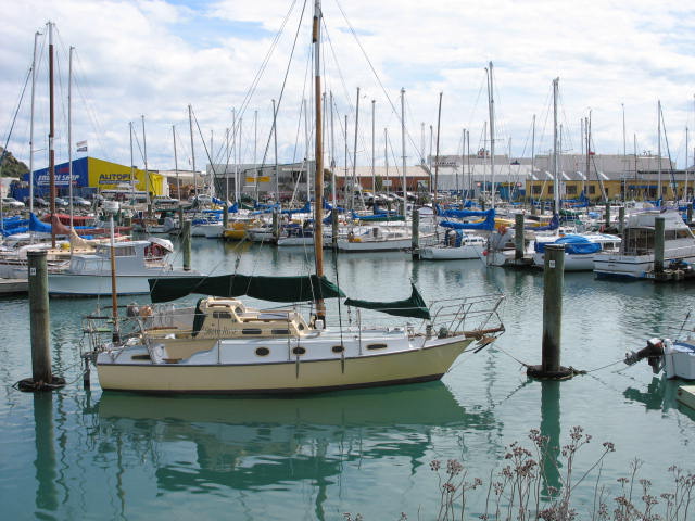 Once we got through the underpass, we turn north again and went out onto a road along the Port of Nelson, New Zealand's third largest and busiest port. We decided to take a pretty picture of all the boats, but there's lots of work going on here too. That is, off to the west.
 To the east, the open bay between shore and the man-made spit are calm waters that many kayakers and new sailors use to practice their skills. Don and I are very interested in learning to kayak--after our amazing trip on Doubtful Sound when we holidayed here--and we'll probably rent a kayak, take a practice round in the pool, and head out into these calmer waters.
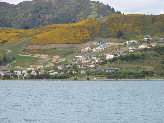 This is looking off in the same direction, but a close-in shot of a new housing area that is being developed just as one arrives in Nelson from the east. We looked at a section there (piece of land) and it had incredible views out toward the bay and looking across to Abel Tasman National Park.
 Looking basically the same direction, but farther to the east, this is a community about 4k and 5 mins outside Nelson city centre called Atawhai--pronounced ata-f-eye, all the "wh" here are "f" in Maori. We've looked here and think we'd like to buy our house in this area, gorgeous views and not terribly populated.
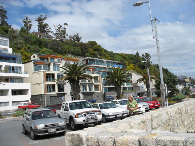 Off the Port of Nelson drive, we headed back and continued westward down one of two main roads connecting Nelson with the next town and major country roadways: Wakefield Quay. Wakefield is the water route, Waimea road is the inland route that goes behind this hill you see in the picture. They both start and end at the same place. They are developing Wakefield Quay big-time, building condos like you see here on the land side. You think they would have done this already, given the views, but I was told by a local that this part of the city was heavily industrial until recent years and is now undergoing a renaissance, understanding that the views are big $$. We are sitting taking the picture from a restaurant and fresh fish shop on the water side. Lots of restaurants overlook the bay. The townhouses on the top floors run nearly NZ $1.0m and up. Lower levels are less, but the noise levels are DREADFUL as this road is constant traffic day and night.
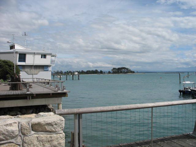 Same spot, taking the photo out toward the water instead. Our timing was impeccable . . .
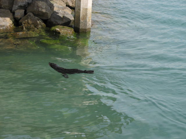 There just happened to be a baby seal swimming and diving and swishing over and over right in the little harbour beneath us. He was adorable and there was a boat watching him, protecting him since he was so close to shore. Not sure who it was, dept. of conservation perhaps?
 Farther out the same way, must have been a sailboat class as the water suddenly became full of sails. Our friends Stefan and Ina, recent immigrants from Berlin, purchased an older sailboat and are refurbishing it. Soon they'll be out on the water too and we hope to join them for a ride. (I'll be sure to take all the motion sickness pills I can find.)
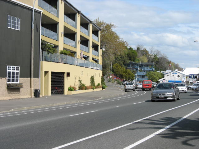 Back to our journey, we headed out onto Wakefield Quay again, they have bike lanes on both sides. Crossing the road is hairy because, as I said, it is nonstop cars all the time. But here is the main highway along the top of the south that connects Picton (and the ferry from the north island) to Nelson to Richmond and then off to Golden Bay and Abel Tasman. Two lanes. One each way. Full of cars. Now imagine what it looks like in summer -- we've gleefully forgotten but we'll be reminded soon enough.
 Another view of our ride along the main road as we keep heading west.
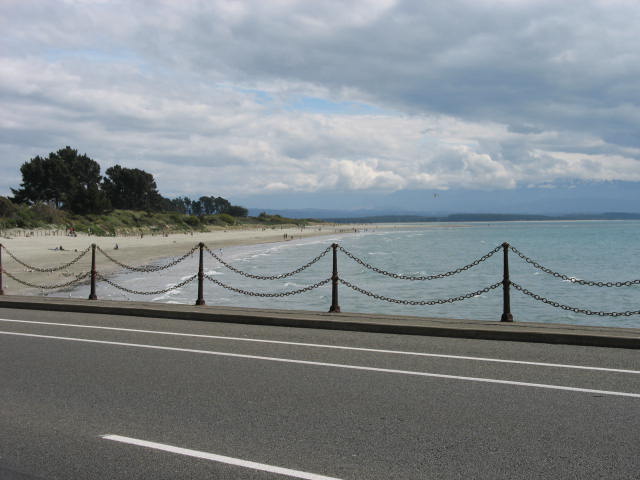 After several kilos we finally arrive in Tahunanui, or Tahuna for short. Pronounced just like it's spelled. It's a neighborhood in Nelson and the main beach in town . . . beautiful sand and shallow water for hundreds of metres out onto the spit. There was even a parasailer or something far in the distance today, not sure he got into the shot. Because this is the beach in town, in summer the kids will spend lots of time here. For us, it's wonderful to go swimming after dinner when it's nearly empty, the threat of sun and UV rays are gone for the day, and the water is still warm from a full day's sunshine. You'll see us here most weekday evenings come summer! We discovered this the easy way when we were on holiday here.
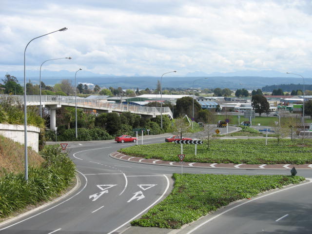 After we biked past Tahuna, we headed west a few more kilos into the main exchange between Nelson and Richmond and beyond. Within the past couple of years the Nelson City Council (my employer, putting in a plug) completed a cycleway to connect all these cities by creating this overpass and a link toward the airport and beyond to Richmond. This picture is of the roundabout to head to Nelson--off to the right out of view, to Stoke--off to the far left, a part of Nelson but its own neighborhood, and toward the airport in Nelson and off beyond to Richmond--straight ahead. Heading back toward us is the "back way" to get to Nelson that we took on the way home--Waimea Road--but didn't get photos of because we were starving and bonking and just wanted to get home to eat some food!! Never leave for a bike ride at noon without having lunch, you think we'd know this!
 To get over that major roundabout, you take this handy bridge, which you can see in the photo above off to the upper right.
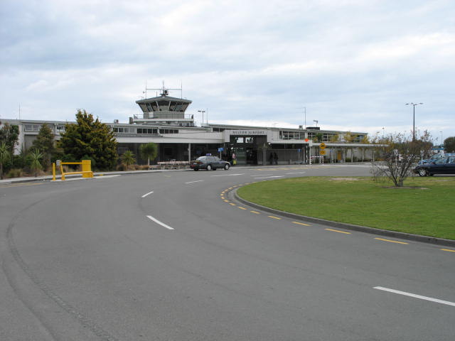 We decided to head first to the airport, rather than to Richmond (mostly cuz we were starving) and take a photo of Nelson's International Gateway-to-the-world Airport. This is where you will land if you come visit us by air. Yep, that's the terminal from beginning to end. Runway behind--yes runway, there's one. It's so secure from all the worldly threats, they even let random cyclists like Don and me bike all around the place on the main road taking photos, scouting out the lay of the place. From here we headed home, as I said, without taking photos, sorry! Another time.
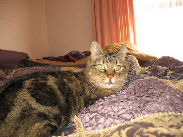 Photo of Livvy thrown in cuz she's so darn cute. She doesn't say hi to Porter. Do you like our comforter of purple and tan and gold with the matching pink curtains?? :)
posted by Don Bartkowiak @ 6:14 pm
2 comments
![]()
![]()

2 Comments:
Thanks for the scenic tour. What a great place to be. It is Indian summer here--in the eighties today and tomorrow and sunny. The fall colors are golden. Love, Dad & Mom
Hey Livvy!! I sure do miss chasing you and dragging you around by your neck! Now I'm with my grandma and grandpa, who love me lots and lots and let me catch mice and drag them around instead of you!! Shucks, there's no one here who I can intimidate and scare! But, I do walk around here in Santa Fe like I'm the king of the world and my grandma and grandpa spoil me rotten!! Missing you lots, Porter
Post a Comment
<< Home