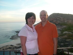
Yesterday we walked to what is called the Center of New Zealand. It is a walk/hike near Nelson city centre just a mile or so from our house. When we got there, we learned that the actual center of the country is about 55 km away--everything is marketing, I guess! But the hike was about a 20 minute walk straight up a hill, zig zagging the entire way, and getting very steep at times. This is a shot of me on a less steep slope. At the top the views of the Nelson region were incredible . . . They extend out to the Abel Tasman and snow capped mountains to the west.

Here is a view to the south of Nelson. If you consider this is a part of a panorama shot, this is the left photo of 3 photos, see more below.

This is the view above the city and this is the center photo in the panorama, the photo above would be to the left of this shot. The bay extends farther than this photo shows, see next photo.

And here is the right side of the panorama shot, but we didn't get the rest of the bay which extends completely out to the right of this photo. Farther right you'd see all water. Those hills in the background of the photo are the Abel Tasman park and towns leading up to it.

I believe this is the Maitai Valley that extends behind Nelson to the west. Don isn't here to verify for me right now, so sorry if I'm wrong! It follows the Maitai River, I know that--you can see it in the center of the picture along the road. We took this photo from the opposite standpoint as the top 3 photos.
 Yesterday we walked to what is called the Center of New Zealand. It is a walk/hike near Nelson city centre just a mile or so from our house. When we got there, we learned that the actual center of the country is about 55 km away--everything is marketing, I guess! But the hike was about a 20 minute walk straight up a hill, zig zagging the entire way, and getting very steep at times. This is a shot of me on a less steep slope. At the top the views of the Nelson region were incredible . . . They extend out to the Abel Tasman and snow capped mountains to the west.
 Here is a view to the south of Nelson. If you consider this is a part of a panorama shot, this is the left photo of 3 photos, see more below.
 This is the view above the city and this is the center photo in the panorama, the photo above would be to the left of this shot. The bay extends farther than this photo shows, see next photo.
 And here is the right side of the panorama shot, but we didn't get the rest of the bay which extends completely out to the right of this photo. Farther right you'd see all water. Those hills in the background of the photo are the Abel Tasman park and towns leading up to it.
 I believe this is the Maitai Valley that extends behind Nelson to the west. Don isn't here to verify for me right now, so sorry if I'm wrong! It follows the Maitai River, I know that--you can see it in the center of the picture along the road. We took this photo from the opposite standpoint as the top 3 photos.


2 Comments:
Thanks for the photos and narrative of your beautiful surroundings. We enlarged the photos and they're so neat. How great to be living within walking distance of this beauty. Love, Dad & Mom
Wow! Very beautiful! Nelson seems much more populated than we thought, but still picturesque and beautiful!! Maybe one day we'll see it all in person! Love, Mom and Richard
Post a Comment
<< Home